The Mathinna goldfield started, like many others, with the discovery of alluvial gold, this time in Black Horse Gully. The area contains one of Tasmania’s largest gold mines, the New Golden Gate, which had a total (historical) production of over 260,000 ounces (~8 tons) of gold. The area is riddled with abandoned mines, prospects, and old workings, and is mostly crown land, meaning fairly easy access. Unlike other areas in Tasmania, the bush is fairly open and easy to walk through, though the grades of the hills are steep. While I have not personally found, nor heard of anyone finding significant nuggets in the area recently, nuggets were found historically in the alluvial areas, and there are many historical artifacts still lying about. Valuable coins such as sovereigns have been found in the area in modern times.
Unfortunately the bush around area is also strewn with rubbish from end to end, as some locals have used it as a tip for decades. Why pay tip fees when you can just tip the rubbish ‘down the gold hole’, or leave it on the side of a track? This can make metal detecting fairly useless in some areas.
A (very) Brief History of the Mathinna goldfield
After the discovery of gold in Mangana in 1852, prospectors fanned out looking for alluvial gold in nearby areas. The whole country between Mangana and Mt Arthur was being talked about as prospective for gold, and it wasn’t long before gold was being dug for at “Black Boy Plains” and “Reedy Marsh”, as the area was known since early on. If you look in historical newspapers and reports, you won’t find references to Mathinna till quite a bit later on, as the name was not officially used till 1872 (in spite of what places like Wikipedia might say). The names “Blackboy” and “Reedy Marsh” seem to be used interchangeably in newspapers of the time to mean Mathinna, but from what I’ve been able to gather, “Black Boy Plains” or “The Blackboy” means the general area where Mathinna now sits, near the confluence of the Dan and Evercreech rivulets with the South Esk, whereas “Reedy Marsh” means specifically the flats at the opening of Black Horse Gully, immediately east of Mathinna, down to approximately the Mathinna – Upper Esk road is nowadays.
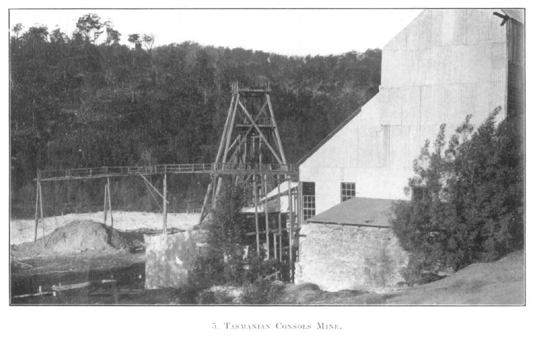
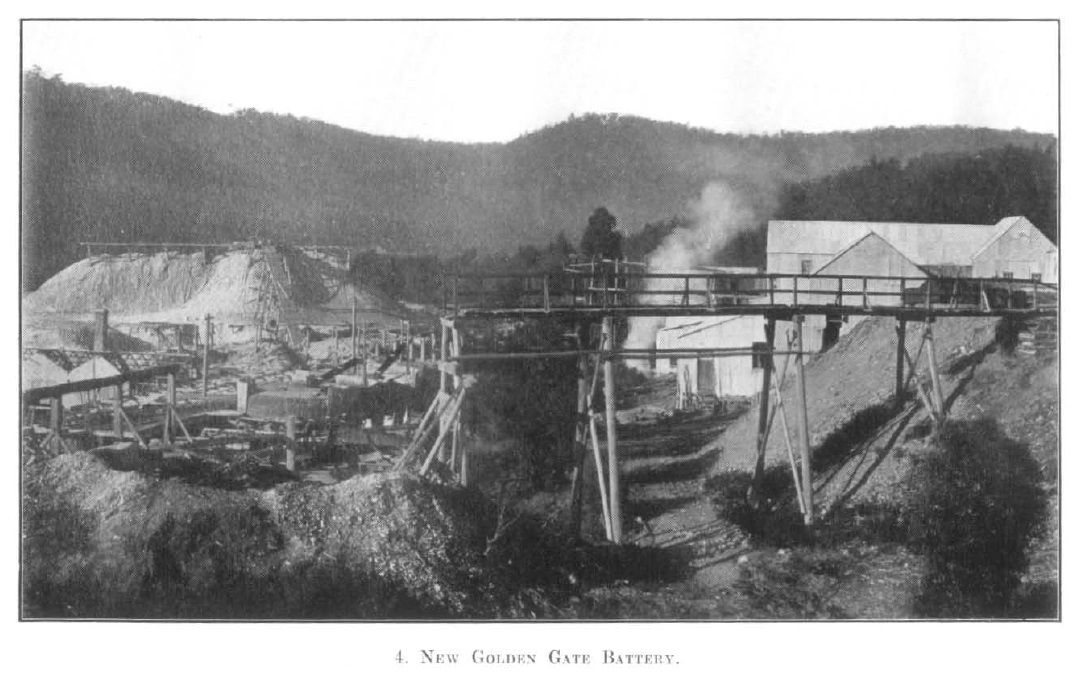
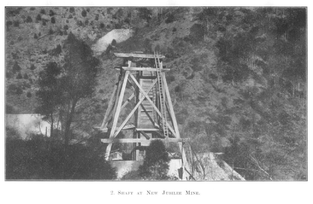
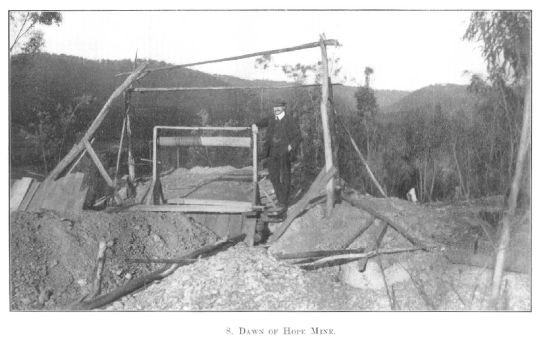
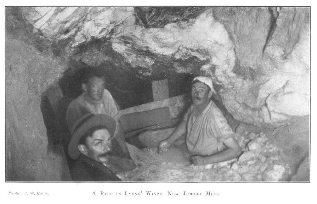
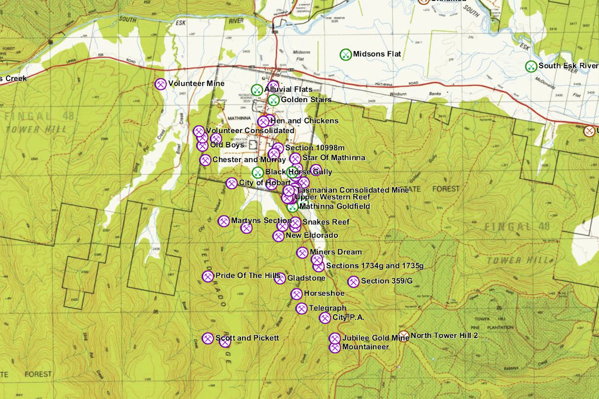
Mines around Mathinna, c. 1914. Source: Twelvetrees (1914). On Some Gold-mining Properties at Mathinna. Geological Survey Report N0. 5, Department of Mines, Hobart, Tasmania.
The mining heyday of Mathinna started with the general surge in mining and prospecting that occurred in 1870, and ended with the closure of the New Golden Gate mine in about 1929. Sporadic re-working of historical mines has occurred ever since, and modern exploration still takes place.
Early workings
It’s difficult to figure out exactly which creeks in the Mathinna goldfield were worked for alluvial gold (unless you walk them), except for the most important ones: Long Gully Creek and Black Horse Gully Creek. Many other small creeks in the area may have been worked, but the most important was Black Horse Gully Creek, where the original alluvial rush took place.
The first mention of the area in relation to gold diggings that I could find dates back to 1853, only a year after the Mangana discovery. By 1856 the area was being reported on as a new goldfield in its own right, but, although gold in quartz was being reported early on, not much happened on mine development until J.M. Dooley developed his claim into the City of Hobart gold mine in 1870 or so. Eventually the New Golden Gate, which was on the east side of the low ridge between Long Gully and Black Horse Gully, would become one of the State’s largest and richest gold mines, with a production of over 260,000 ounces, and a life of about 75 years (by comparison, only the Tasmania mine at Beaconsfield, the modern Henty gold mine, and the Mt Lyell copper mine, which produced gold as a by-product, mined more gold than the New Golden Gate).
You can plot the location of all known historic prospects, mines and alluvial workings in the Mathinna goldfield by overlaying the MRTmap Mineral Occurrences layer.
Gold exploration
-
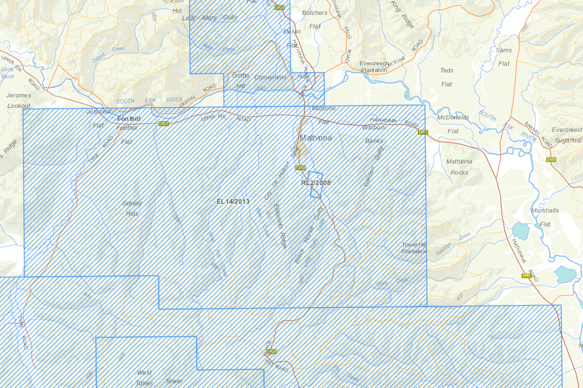
- Modern exploration around Mathinna (Source: MRTmap)
-
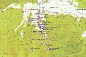
- Historic mines and prospects in the Mathinna area (Source: MRTmap)
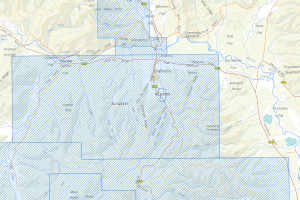
As I said in the opening sentence, most of the land around Mathinna and most historical prospects are in public (crown) land. However, as of July 2015, almost the whole of the Mathinna area is under exploration licence EL14/2013, held by Mathinna Gold Pty Ltd. You can find additional contact information for them on their website. The remainder, which covers the area of tailings of the New Golden Gate mine, is under retention licence RL2/2008. This is held by Cala Resources, who have the same postal address as Mathinna Gold Pty Ltd, and is probably owned by the same people, so if you’re seeking permission (as you are required to do if you hold a prospecting licence), you can kill two birds with one stone.
Prior exploration reports
There are quite a few exploration reports on the Mathinna goldfield, way too many for me to list here. The best way to look for them is to do a Google search within the MRT library, as I described in my previous post on the northeast goldfields.
Two of the more useful ones I’ve come across are:
- Mconie 1983: A Review of the Gold Potential of North Eastern Tasmania.
- MacDonald 1996: Resolute Samantha Ltd Annual Report 1995, EL17/1991, Mathinna. (Good summaries of other exploration in the general area)
Older official reports
Since the Mathinna goldfield contained historically the second largest gold mine in Tasmania, it has been written about more than most other goldfields. The main historical reports I’ve come across are:
- Thureau 1884: Report on the Mount Victoria, Dan Rivulet, Black Boy, and Mangana Gold Fields.
- Montgomery 1892: Report on the Mathinna Goldfield.
- Twelvetrees 1906a: Report on the Mathinna Goldfield. Part I.
- Twelvetrees 1906b: Report on the Mathinna Goldfield. Part II.
- Twelvetrees 1907: The Mathinna Goldfield. Part III.
- Twelvetrees 1914: On Some Gold-mining Properties at Mathinna.
- Finucaine 1935: Mathinna and Tower Hill Goldfields.
- Taheri 1992: A summary of the Tower Hill, Mathinna and Dans Rivulet Goldfields.
Do you have any suggestions for what you’d like to see in future posts? If you like the content at Apple Isle Prospector, feel free to get in contact, or leave a comment.